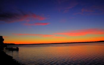

Scientists have developed a database on US Northeast and Midwest lakes like Monona in Wisc.
Credit: NSF LTER Network
Countless numbers of vacationers spent this summer enjoying lakes for swimming, fishing and boating. But are they loving these lakes to death?
The water quality of the nation's lakes is threatened not only by the things people do in and around them, but, say scientists, by less obvious factors such as agriculture and changes in climate. Because lakes are as distinct as one snowflake from another, they may respond differently to these challenges.
To better understand the complex factors that threaten lake water quality, scientists need data on many lakes in various environmental settings. Unfortunately, much of the lake and geographic data needed for such studies is not easily accessible. The datasets exist in multiple formats in government, university and private databases – and sometimes in file drawers.
Now, a new “geography of lake water quality,” called LAGOS, is allowing scientists to understand lakes in ways that will better inform water policy and management. LAGOS, or the LAke multi- scaled GeOSpatial and temporal database, includes information on 50,000 lakes in 17 U.S. Northeastern and upper Midwestern states.
A team of 80 scientists in fields including limnology, ecology, computer science, geographic and information sciences, and other disciplines developed LAGOS. Their recent paper in the journal GigaScience makes the results available to researchers, policymakers and the public.
“We're at an exciting time in environmental science, when people are recognizing that the big problems we face require us to work together across disciplinary boundaries and to openly share data, methods and tools,” said paper co- author Kendra Cheruvelil, a scientist at Michigan State University (MSU).
With funding from the National Science Foundation (NSF), the researchers collected water quality information from scientists, government and tribal environmental agency personnel, and citizens.
“Efforts like LAGOS can build the capacity for broad-scale research on the environment,” said lead author Patricia Soranno, also of MSU. “They've driven home the importance of Big Data approaches that are very collaborative so science can better inform policy and management to preserve water quality for future generations.”
The resulting database is the work of dozens of people who collected and processed water quality data, thousands of others who shared water quality data, and more than 15 researchers who worked together for several years.
The LAGOS team gathered information for 50,000 lakes in 17 states from digital maps — melding land use, geology and climate data — and combined it with water quality data.
“High-quality, long-term data are essential to addressing questions about ecosystem change,” said David Garrison, chair of the NSF Long-Term Ecological Research (LTER) Working Group. “This is a wonderful resource for researchers and managers focused on lakes and other aquatic ecosystems.”
NSF LTER and other scientists are participants in the LAGOS project, including those funded by NSF's MacroSystems Biology, Critical Zone Observatory, and Water Sustainability and Climate programs.
“Enabling access to clean drinking water and the services lakes provide, such as fishing and recreation, are among the greatest environmental challenges we face today,” said Liz Blood, program director for NSF's MacroSystems Biology program.
“Now, a comprehensive database has been created that will provide easy access to information on water quality, and the physical and ecological factors that affect it, across scales from individual lakes to entire regions,” Blood said. “It will be a valuable resource for researchers, managers, landowners and citizen scientists to evaluate the many factors affecting lakes.”
Added Richard Yuretich, program director for NSF's Critical Zone Observatory program, “This information on thousands of lakes will enable reliable analyses of water quality trends over space and time. It will be very helpful in assessing controls on lake health such as population growth, land use, and climate, and will benefit environmental and human well-being now and in the future.”
LAGOS scientists hope the database will encourage more research on lakes, which, said Soranno, are an important part of many people's lives.
Added co-author Corinna Gries, an information scientist at the University of Wisconsin, “This is a great example of how environmental research can leverage a wide range of information, such as map-based data from Google Earth, and combine it with water samples collected by scientists and citizens.”


