


Feeding 9 Billion: Innovations in Agricultural Modeling
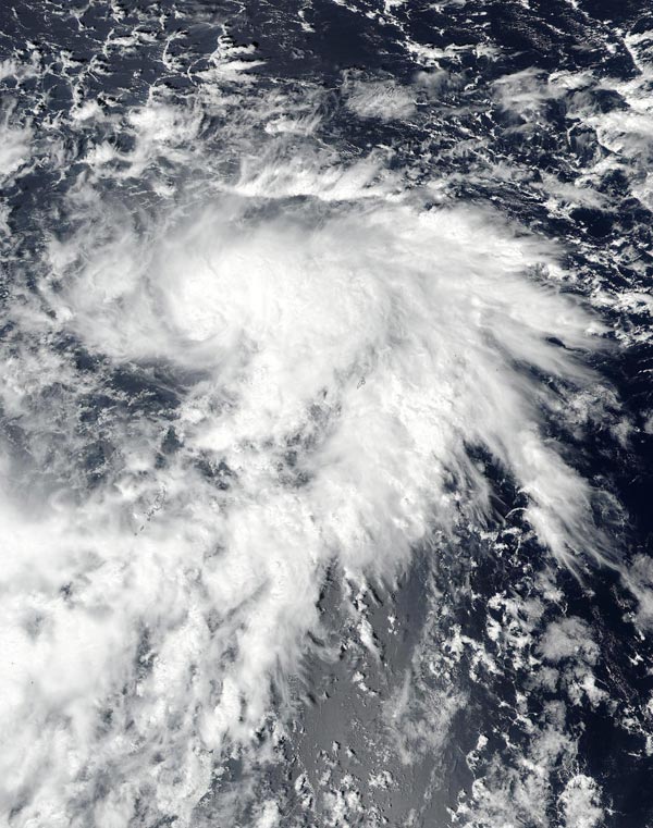
On Oct. 16 at 12 a.m. EDT (0400 UTC) the NASA-NOAA's Suomi NPP provided a visible image of the storm. The image showed the bulk of clouds were on the eastern side of the storm.
Credit: NOAA/NASA Goddard Rapid Response Team
Tropical Storm Lan developed on Oct. 15 and has been moving to the west-northwest over open ocean.
On Oct. 16 at 12 a.m. EDT (0400 UTC) the VIIRS instrument aboard NASA-NOAA's Suomi NPP satellite provided a visible image of the storm. The image showed the bulk of clouds were on the eastern and southeastern sides of the storm indicating the storm was being affected by vertical wind shear.
At 11 a.m. EDT (1500 UTC) Tropical storm Lan was centered near 10.8 degrees north latitude and 133.1 degrees east longitude, about 214 nautical miles north-northwest of Koror, Palau. It was moving to the west 12 knots (13.8 mph/22.2 kph) and had maximum sustained winds near 35 knots (40 mph/62 kph).
The Joint Typhoon Warning Center noted that Lan is intensifying and is expected to become a typhoon over the open waters of the western Pacific.


The ‘Barbarian Conspiracy’ of 367 CE was one of the most severe threats to Rome’s hold on Britain since the Boudiccan revolt three centuries earlier. Contemporary sources indicate that components of the garrison on Hadrian’s wall rebelled and allowed the Picts to attack the Roman province by land and sea. Simultaneously, the Scotti from modern-day Ireland invaded broadly in the west, and Saxons from the continent landed in the south. Senior Roman commanders were captured or killed, and some soldiers…

In the global carbon cycle microorganisms have evolved a variety of methods for fixing carbon. Researchers from Bremen and Taiwan have investigated the methods that are utilized at extremely hot, acidic and sulfur-rich hydrothermal vents in shallow waters off the island of Kueishantao, Taiwan. A team working with first author Joely Maak of MARUM – Center for Marine Environmental Sciences at the University of Bremen has now published their study in the professional journal Biogeosciences. Extremely harsh conditions can be…

The sun may rise every morning, but the amount of sunlight reaching the Earth’s surface can substantially vary over decades, according to a perspectives article led by an international research team. The article, published on March 15 in Advances in Atmospheric Science, suggests that stages of “dimming” and “brightening” correspond with increased air pollution and implementation of clean energy solutions, respectively. “The amount of sunlight — which is solar radiative energy — we receive at the Earth’s surface is not…

New research explores geological processes along plate boundaries Being a geophysicist can sometimes feel like being a detective —uncovering clues, and then building a case based on the evidence. In a new article published in Science Advances, a collaborative team led by the Woods Hole Oceanographic Institution (WHOI), presents a never-before-seen image of an oceanic transform fault from electromagnetic (EM) data collected at the Gofar fault in the eastern Pacific Ocean. The National Science Foundation funded work reveals unexpected brine…


