


Feeding 9 Billion: Innovations in Agricultural Modeling
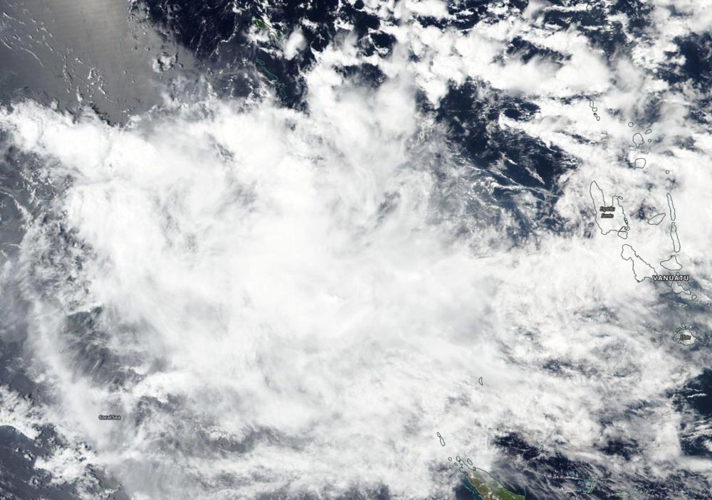
On Dec.4, the VIIRS instrument aboard NASA-NOAA's Suomi NPP satellite captured a visible image of Tropical Storm Owen in the Coral Sea, South Pacific Ocean. Owen was southwest of Vanuatu.
Credit: NASA Worldview, Earth Observing System Data and Information System (EOSDIS)
In general, wind shear is a measure of how the speed and direction of winds change with altitude. Winds at different levels of the atmosphere pushed against the cylindrical circulation center and skewed it, weakening the rotation.
As a result of the wind shear, Owen weakened from a tropical storm to a tropical depression on Dec. 4.
Early on Dec. 4 the Visible Infrared Imaging Radiometer Suite (VIIRS) instrument aboard NASA-NOAA's Suomi NPP satellite analyzed Owen, and showed a disorganized storm with little thunderstorm development.
The bulk of the clouds and showers were pushed east of the center of circulation from wind shear.
On Dec. 4 at 10 a.m. EDT (1500 UTC) Owen's maximum sustained winds had dropped to 34.5 mph (30 knots/55.5 kph). It was located approximately 519 nautical miles east of Cairns, Australia. Owen was moving westward.
Although it is a depression, the Joint Typhoon Warning Center noted that there is a chance the storm may re-strengthen after two days when the wind shear is expected to relax. Forecasters are keeping an eye on Owen.


The ‘Barbarian Conspiracy’ of 367 CE was one of the most severe threats to Rome’s hold on Britain since the Boudiccan revolt three centuries earlier. Contemporary sources indicate that components of the garrison on Hadrian’s wall rebelled and allowed the Picts to attack the Roman province by land and sea. Simultaneously, the Scotti from modern-day Ireland invaded broadly in the west, and Saxons from the continent landed in the south. Senior Roman commanders were captured or killed, and some soldiers…

In the global carbon cycle microorganisms have evolved a variety of methods for fixing carbon. Researchers from Bremen and Taiwan have investigated the methods that are utilized at extremely hot, acidic and sulfur-rich hydrothermal vents in shallow waters off the island of Kueishantao, Taiwan. A team working with first author Joely Maak of MARUM – Center for Marine Environmental Sciences at the University of Bremen has now published their study in the professional journal Biogeosciences. Extremely harsh conditions can be…

The sun may rise every morning, but the amount of sunlight reaching the Earth’s surface can substantially vary over decades, according to a perspectives article led by an international research team. The article, published on March 15 in Advances in Atmospheric Science, suggests that stages of “dimming” and “brightening” correspond with increased air pollution and implementation of clean energy solutions, respectively. “The amount of sunlight — which is solar radiative energy — we receive at the Earth’s surface is not…

New research explores geological processes along plate boundaries Being a geophysicist can sometimes feel like being a detective —uncovering clues, and then building a case based on the evidence. In a new article published in Science Advances, a collaborative team led by the Woods Hole Oceanographic Institution (WHOI), presents a never-before-seen image of an oceanic transform fault from electromagnetic (EM) data collected at the Gofar fault in the eastern Pacific Ocean. The National Science Foundation funded work reveals unexpected brine…


