


Feeding 9 Billion: Innovations in Agricultural Modeling
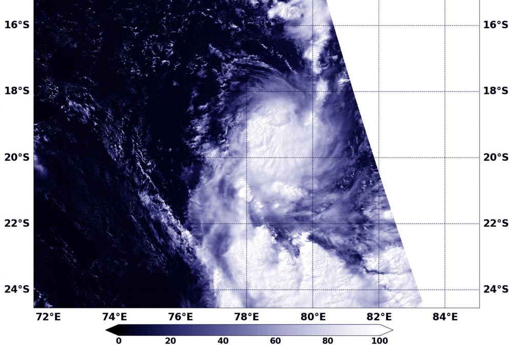
NASA's Terra satellite captured an image of the birth of Tropical Cyclone 17S in the Southern Indian Ocean on March 29.
Credits: NASA/NRL
The storm formed on March 28 around 2100 UTC (5 p.m. EDT) and strengthened into a tropical storm. At 0900 UTC (5 a.m. EDT), Tropical cyclone 17S's maximum sustained winds were near 40 knots (46 mph/74 kph).
It was located near 17.8 degrees south latitude and 78.3 degrees east longitude, about 726 nautical miles south-southeast of Diego Garcia. It was moving to the south at 15 knots (17.2 mph/27.7 kph).
When NASA's Terra satellite passed over the storm the Moderate Resolution Imaging Spectroradiometer instrument aboard captured a visible image showing a slightly elongated storm with wind shear pushing clouds south of the well- defined low-level center.
The Joint Typhoon Warning Center forecast calls for 17S to continue moving south and maintain current strength. After two days, adverse conditions are expected to lead to its demise as dry air approaches the system.


In the global carbon cycle microorganisms have evolved a variety of methods for fixing carbon. Researchers from Bremen and Taiwan have investigated the methods that are utilized at extremely hot, acidic and sulfur-rich hydrothermal vents in shallow waters off the island of Kueishantao, Taiwan. A team working with first author Joely Maak of MARUM – Center for Marine Environmental Sciences at the University of Bremen has now published their study in the professional journal Biogeosciences. Extremely harsh conditions can be…

The sun may rise every morning, but the amount of sunlight reaching the Earth’s surface can substantially vary over decades, according to a perspectives article led by an international research team. The article, published on March 15 in Advances in Atmospheric Science, suggests that stages of “dimming” and “brightening” correspond with increased air pollution and implementation of clean energy solutions, respectively. “The amount of sunlight — which is solar radiative energy — we receive at the Earth’s surface is not…

New research explores geological processes along plate boundaries Being a geophysicist can sometimes feel like being a detective —uncovering clues, and then building a case based on the evidence. In a new article published in Science Advances, a collaborative team led by the Woods Hole Oceanographic Institution (WHOI), presents a never-before-seen image of an oceanic transform fault from electromagnetic (EM) data collected at the Gofar fault in the eastern Pacific Ocean. The National Science Foundation funded work reveals unexpected brine…

Study shows contrast between wet and dry areas increases rain by up to 30% Storm forecasting is traditionally based on studying atmospheric conditions but ground-breaking research that also looks at land surface conditions is set to transform early warning systems in tropical regions. This will enable communities to better adapt to the destructive impacts of climate change. The new study led by the UK Centre for Ecology & Hydrology (UKCEH) has shown that a large contrast in soil moisture levels…


