Twenty-first depression forms in eastern Pacific Ocean

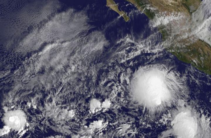
On Nov. 18 at 1500 UTC (10:00 a.m. EST), the NOAA's GOES-West satellite saw the Tropical Depression 21E form well southwest of the western Mexican coast. Credits: NASA/NOAA GOES Project
On Nov. 18 at 1500 UTC (10:00 a.m. EST), the NOAA's GOES-West satellite saw the Tropical Depression 21E form well southwest of the western Mexican coast. The storm appeared rounded in GOES imagery, but the storm was being affected by wind shear.
Forecaster Kimberlain at the National Hurricane Center said “These data and first-light visible satellite imagery also indicate that the center of the cyclone is near the southeastern edge of large mass of cold-topped convection, suggesting the presence of some southeasterly [vertical wind] shear.”
At 11 a.m. EST (1600 UTC), the center of Tropical Depression Twenty-One-E was located near latitude 13.0 north, longitude 107.2 west.
That puts the center about 455 miles (735 km) south-southwest of Manzanillo, Mexico. The estimated minimum central pressure is 1005 millibars.
The depression was moving toward the north near 2 mph (4 kph), and this general motion is expected to continue today.
A turn toward the north-northwest and then northwest is expected Thursday and Friday with an increase in forward speed. Maximum sustained winds are near 35 mph (55 km/h) with higher gusts.
Some strengthening is forecast during the next 48 hours, and the depression is expected to become a tropical storm tonight or Thursday, Nov. 19.
The National Hurricane Center forecast track turns the storm away from the coast, toward the west-northwest. For updated forecasts, visit: http://www.
Media Contact
All latest news from the category: Earth Sciences
Earth Sciences (also referred to as Geosciences), which deals with basic issues surrounding our planet, plays a vital role in the area of energy and raw materials supply.
Earth Sciences comprises subjects such as geology, geography, geological informatics, paleontology, mineralogy, petrography, crystallography, geophysics, geodesy, glaciology, cartography, photogrammetry, meteorology and seismology, early-warning systems, earthquake research and polar research.
Newest articles

NASA: Mystery of life’s handedness deepens
The mystery of why life uses molecules with specific orientations has deepened with a NASA-funded discovery that RNA — a key molecule thought to have potentially held the instructions for…

What are the effects of historic lithium mining on water quality?
Study reveals low levels of common contaminants but high levels of other elements in waters associated with an abandoned lithium mine. Lithium ore and mining waste from a historic lithium…

Quantum-inspired design boosts efficiency of heat-to-electricity conversion
Rice engineers take unconventional route to improving thermophotovoltaic systems. Researchers at Rice University have found a new way to improve a key element of thermophotovoltaic (TPV) systems, which convert heat…


