New measurements shed light on the impact of water temperatures on glacier calving

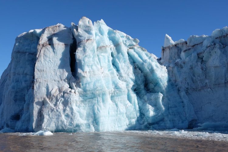
Glacier in Svalbard. Credit: Nina Kirchner/Stockholm University
“One of the greatest uncertainties surrounding future sea level rise is how glacier dynamics change when glaciers come into contact with warming waters. Our measurements and results can be used to improve numerical models which estimate future sea level rise” says Felicity Holmes, a PhD student at the Department of Physical Geography, Stockholm University, and lead author of the study.
Many glaciers in the polar regions are shrinking due to global warming, contributing to sea level rise. Glaciers which extend into water don't only lose mass through melting on the surface, but also through the loss of icebergs in a process called calving.
“Calving is a process which is not completely understood, but with the measurement technology that we used in Svalbard, we have a good opportunity to increase our knowledge of which factors interact when glaciers calve. A better understanding of calving processes also benefits prognoses of how glaciers in West Antarctica will react to warming waters” says Nina Kirchner, Associate professor in glaciology at the Department of Physical Geography, Stockholm University, and director of the Bolin Centre for climate research.
When warm water from the Atlantic intrudes into fjords where glaciers meet the ocean, calving rates increase. This is seen along the west coast of Svalbard. But, the lack of data in close proximity to glacier fronts has made it hard to clearly identify warm water as the cause, due to the fact that measurements taken further away often give an incorrect picture of the water masses that actually reach the glacier fronts. This can therefore lead to an over- or under- estimation of how much the ocean actually impacts calving glaciers.
The new datasets are the first taken within just a kilometre of the glacier fronts and therefore play an important role in increasing our understanding of the impact of subsurface temperatures along Svalbard's west coast.
“It is exciting to develop measurement technology in close co-operation with climate scientists – together we work to make the technology cope with the tough challenges that the polar environment places on underwater instruments” says Jakob Kuttenkeuler, Professor at the Maritime Robotics Laboratory at the Royal Institute of Technology (KTH).
“We are proud of the unique measurements that we could collect in close proximity to the glacier fronts over the course of a whole year – the measurement series is now openly available to other researchers to use” concludes Holmes.
###
The study is published in Scientific Reports and the whole article is available to read here: https:/
Media Contact
More Information:
http://dx.doi.org/10.1038/s41598-019-45077-3All latest news from the category: Earth Sciences
Earth Sciences (also referred to as Geosciences), which deals with basic issues surrounding our planet, plays a vital role in the area of energy and raw materials supply.
Earth Sciences comprises subjects such as geology, geography, geological informatics, paleontology, mineralogy, petrography, crystallography, geophysics, geodesy, glaciology, cartography, photogrammetry, meteorology and seismology, early-warning systems, earthquake research and polar research.
Newest articles

A ‘language’ for ML models to predict nanopore properties
A large number of 2D materials like graphene can have nanopores – small holes formed by missing atoms through which foreign substances can pass. The properties of these nanopores dictate many…

Clinically validated, wearable ultrasound patch
… for continuous blood pressure monitoring. A team of researchers at the University of California San Diego has developed a new and improved wearable ultrasound patch for continuous and noninvasive…

A new puzzle piece for string theory research
Dr. Ksenia Fedosova from the Cluster of Excellence Mathematics Münster, along with an international research team, has proven a conjecture in string theory that physicists had proposed regarding certain equations….


