Arctic wintertime sea ice extent is among lowest on record

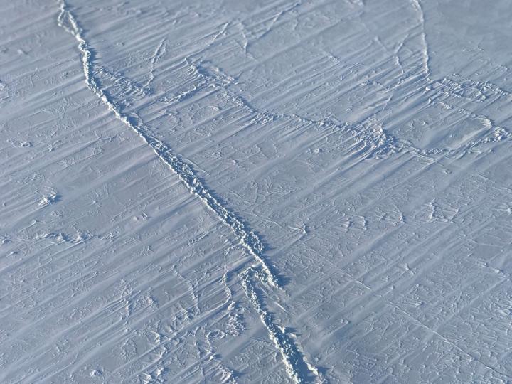
On March 17, the Arctic sea ice cover peaked at 5.59 million square miles (14.48 million square kilometers), making it the second lowest maximum on record. Credits: NASA/ Nathan Kurtz
On March 17, the Arctic sea ice cover peaked at 5.59 million square miles (14.48 million square kilometers), making it the second lowest maximum on record, at about 23,200 square miles (60,000 square kilometers) larger than the record low maximum reached on March 7, 2017.
More significantly from a scientific perspective, the last four years reached nearly equally low maximum extents and continued the decades-long trend of diminishing sea ice in the Arctic. This year's maximum extent was 448,000 square miles (1.16 million square kilometers) — an area larger than Texas and California combined – below the 1981 to 2010 average maximum extent.
Every year, the sea ice cover blanketing the Arctic Ocean and surrounding seas thickens and expands during the fall and winter, reaching its maximum yearly extent sometime between late February and early April. The ice then thins and shrinks during the spring and summer until it reaches its annual minimum extent in September. Arctic sea ice has been declining both during the growing and melting seasons in recent decades.
The decline of the Arctic sea ice cover has myriad effects, from changes in climate and weather patterns to impacts on the plants and animals dependent on the ice, and to the indigenous human communities that rely on them. The disappearing ice is also altering shipping routes, increasing coastal erosion and affecting ocean circulation.
“The Arctic sea ice cover continues to be in a decreasing trend and this is connected to the ongoing warming of the Arctic,” said Claire Parkinson, senior climate scientist at NASA's Goddard Space Flight Center in Greenbelt, Maryland. “It's a two-way street: the warming means less ice is going to form and more ice is going to melt, but also, because there's less ice, less of the sun's incident solar radiation is reflected off, and this contributes to the warming.”
The Arctic has gone through repeated warm episodes this winter, with temperatures climbing more than 40 degrees above average in some regions. The North Pole even experienced temperatures above the freezing point for a few days in February.
In mid-March, cooler temperatures and winds pushed out the edge of the sea ice pack and caused a late surge in ice growth that brought the maximum extent closer in line with the past few years.
In February, a large area of open water appeared in the sea ice cover north of Greenland, within the multiyear ice pack — the Arctic's oldest and thickest ice. Most of the opening has refrozen but the new ice is expected to be thinner and more fragile, and a new opening might appear during the melt season. This could make the ice in this region more mobile and prone to exiting the Arctic this summer through either the Fram or Nares straits, ultimately melting in the warmer waters of the Atlantic Ocean.
“This old, thicker ice is what we expect to provide stability to the Arctic sea ice system, since we expect that ice not to be as vulnerable to melting out as thinner, younger ice,” said Alek Petty, a sea ice researcher at Goddard. “As ice in the Arctic becomes thinner and more mobile, it increases the likelihood for rapid ice loss in the summer.”
Despite the fact that this year's melt season will begin with a low winter sea ice extent, this doesn't necessarily mean that we will see another record low summertime extent.
“A lot will depend on what the wind and temperature conditions will be in the spring and summer,” Parkinson said.
Starting March 22, Operation IceBridge, NASA's aerial survey of polar ice, is flying over the Arctic Ocean to map the distribution and thickness of sea ice. In the fall, NASA will launch a new satellite mission, the Ice, Cloud and Land Elevation Satellite-2 (ICESat-2), which will continuously monitor how sea ice thickness is changing across the Arctic.
For NSIDC's analysis: http://nsidc.
Media Contact
All latest news from the category: Earth Sciences
Earth Sciences (also referred to as Geosciences), which deals with basic issues surrounding our planet, plays a vital role in the area of energy and raw materials supply.
Earth Sciences comprises subjects such as geology, geography, geological informatics, paleontology, mineralogy, petrography, crystallography, geophysics, geodesy, glaciology, cartography, photogrammetry, meteorology and seismology, early-warning systems, earthquake research and polar research.
Newest articles

First-of-its-kind study uses remote sensing to monitor plastic debris in rivers and lakes
Remote sensing creates a cost-effective solution to monitoring plastic pollution. A first-of-its-kind study from researchers at the University of Minnesota Twin Cities shows how remote sensing can help monitor and…

Laser-based artificial neuron mimics nerve cell functions at lightning speed
With a processing speed a billion times faster than nature, chip-based laser neuron could help advance AI tasks such as pattern recognition and sequence prediction. Researchers have developed a laser-based…

Optimising the processing of plastic waste
Just one look in the yellow bin reveals a colourful jumble of different types of plastic. However, the purer and more uniform plastic waste is, the easier it is to…


