Earth Sciences (also referred to as Geosciences), which deals with basic issues surrounding our planet, plays a vital role in the area of energy and raw materials supply.
Earth Sciences comprises subjects such as geology, geography, geological informatics, paleontology, mineralogy, petrography, crystallography, geophysics, geodesy, glaciology, cartography, photogrammetry, meteorology and seismology, early-warning systems, earthquake research and polar research.

Global warming will not be helped much by efforts to reduce carbon dioxide emission into the atmosphere, say two scientists who have studied the matter.
Dr. Nir Shaviv, an astrophysicist from the Racah Institute of Physics of the Hebrew University of Jerusalem, and Prof. Jan Veiser a geochemist at the University of Ottawa in Canada and Ruhr University in Germany, say that temperature variations are due more to cosmic forces than to the actions of man.
In a recent article publishe

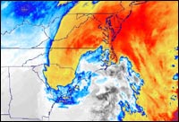
Scientists in sunny, hot Florida are thinking cold thoughts since they added ozone measurements from a NASA satellite into computer weather forecast models and improved several factors in a forecast of a major winter snowstorm that hit the United States in 2000.
When scientists added ozone measurements, predictions of snowstorm intensity, snowfall amounts and the storm track all improved for a storm that hit Washington, D.C. As such, they may be able to do the same for future storms,

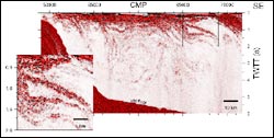
A new application of a decades-old technique to study Earth´s interior is allowing scientists “see” the layers in the ocean, providing new insight on the structure of ocean currents, eddies and mixing processes. The findings, reported in this week´s Science by a team from the University of Wyoming and Woods Hole Oceanographic Institution (WHOI), could be a major step forward in the ability to remotely survey the interior of the ocean.
The study reports on a new adaptation of seismic

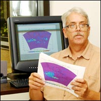
It´s tricky, this weather business — predicting drought, floods, rain or snow, especially months in advance. But NASA scientists at the National Space Science and Technology Center in Huntsville, Ala., are working to take the guesswork out of long-term prediction.
“We´re researching methods to predict precipitation a season or more in advance,” said Dr. Bob Oglesby, a senior atmospheric scientist at the research center. The key, he said, is understanding how the atmosphere interacts with th

Multiple sensors on ESA’s Envisat environmental satellite have been used to peer beneath a vast pall of smoke above tropical Borneo and detect fire hotspots – known to add millions of tons of harmful greenhouse gases to the atmosphere.
Fires occur often during the dry season on the South East Asian island of Borneo, but it isn’t only the forests that burn. Lowland tropical peat swamps are formed from layers of woody debris too waterlogged to fully decompose. Slowly deposited over thousands

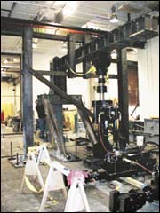
On Wednesday, July 30, as scientists all over the country looked intently on, a synthetic earthquake shook a half-real building.
Part of the structure was conventional steel: full-sized structural support columns sitting in laboratories at the University of Colorado and the University of Illinois at Urbana-Champaign (UIUC).
But a third support column and the building floor that rested on them, forming a typical 1-story, 2-bay component of a modern steel frame building, exist