Uncovering mysteries beneath the Earth’s surface

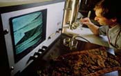
Back in the old days, when doctors looked for tumors, exploratory surgery was the only option. Today they use CAT scans, x-rays, ultrasound, and other non-intrusive methods for checking out what lies beneath the skin’s surface. But how do we determine what is beneath the Earth’s surface? Invasive surgery on the Earth is just as dated as doctors’ old methods of finding tumors, if you ask Eric Miller, associate professor of electrical and computer engineering at Northeastern University. If we humans can rely on CAT scans to form three-dimensional computer models of our insides, surely “CAT scans for the Earth” can be valuable in finding contaminants such as nuclear waste, to replace drilling and other harmful methods. Miller and his team, with funding from the Department of Energy, are busily toiling away on this very kind of environmental remediation and monitoring.
For much of the last half of the last century, waste was disposed of in less-than-careful ways. This waste was generated from the buildup of the country’s nuclear stockpile. In many locations, there’s a question about just what is in the earth and how it’s moving – a question that can be answered by digging up large tracks of land. But Miller says that not only is digging not economically feasible, it can also be dangerous if contaminants are exposed and not treated properly.
“One of the legacies of the Cold War is the proliferation of buried chemical and radioactive waste on the grounds of many Department of Energy labs,” says Miller. “While people know roughly where material is buried, it is often the case that detailed records are not available. Working with the DOE National Lab in Idaho, we have been exploring processing methods designed to develop a ‘map’ of the subsurface which is required before excavation can begin.”
CAT scans of the Earth involve imaging of the planet’s internal structure, which is useful for two reasons. First, the images can be used to “see” where the contaminants are, how they are moving, and how successful the treatment of the contaminants is. Second, images can help determine the details of the sedimentary structure of the Earth in regions where contaminants are located. Imaging can then be used to develop maps so we can see or predict where the contaminants may flow in the future.
With medical imaging, doctors are free to place the patient in a machine that collects data from all around him or her, but with the Earth, experts are constrained in terms of where data can be collect data from: the surface and boreholes. This means that the data makes high quality image formation much more difficult. Miller and his team are developing new methods to improve the resolution of the resulting images. The work is conducted in close collaboration with geophysicists and hydrologists from the Department of Energy, who can use Miller’s information to analyze the “fate and transport” of the contaminants flowing through the earth.
Located in the heart of Boston, Northeastern University is a private institution recognized for its expert faculty, first-rate academic and research facilities and flagship co-op program. The co-op program, which combines classroom learning with real-world experience, has been cited for excellence for two years running by U.S. News & World Report. Recently named a top college in the northeast by the Princeton Review, Northeastern’s career services was awarded top honors by Kaplan Newsweek’s “Unofficial Insiders Guide to the 320 Most Interesting Colleges and Universities,” 2003 edition. For more information, please visit www.northeastern.edu.
Media Contact
All latest news from the category: Earth Sciences
Earth Sciences (also referred to as Geosciences), which deals with basic issues surrounding our planet, plays a vital role in the area of energy and raw materials supply.
Earth Sciences comprises subjects such as geology, geography, geological informatics, paleontology, mineralogy, petrography, crystallography, geophysics, geodesy, glaciology, cartography, photogrammetry, meteorology and seismology, early-warning systems, earthquake research and polar research.
Newest articles

Innovative 3D printed scaffolds offer new hope for bone healing
Researchers at the Institute for Bioengineering of Catalonia have developed novel 3D printed PLA-CaP scaffolds that promote blood vessel formation, ensuring better healing and regeneration of bone tissue. Bone is…

The surprising role of gut infection in Alzheimer’s disease
ASU- and Banner Alzheimer’s Institute-led study implicates link between a common virus and the disease, which travels from the gut to the brain and may be a target for antiviral…

Molecular gardening: New enzymes discovered for protein modification pruning
How deubiquitinases USP53 and USP54 cleave long polyubiquitin chains and how the former is linked to liver disease in children. Deubiquitinases (DUBs) are enzymes used by cells to trim protein…


