Tapah downgrades to a depression

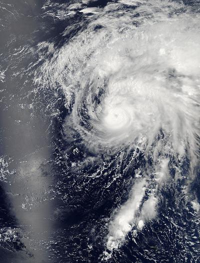
Aqua captured this image of the tropical depression Tapah on April 29, 2014, at 11:55 p.m. EDT (3:55 UTC) in the western Pacific Ocean. Credit: NASA Goddard's MODIS Rapid Response Team
Tapah rapidly dissipated due to the effected of strong vertical windshear from the west and a sharp decreased in sea surface temperature.
The storm is currently tracking northwest at 10 knots per hour and is expected to recurve to the northeast and accelerate.
Maximum wave height is currently 10 feet. The storm will be monitored for signs of regeneration.
NASA captured this image of the storm with the Moderate Resolution Imaging Spectroradiometer or MODIS instrument aboard NASA's Aqua satellite on April 29, 2014 at 11:55 p.m. EDT (3:55 UTC) in the western Pacific Ocean.
Media Contact
More Information:
http://www.nasa.govAll latest news from the category: Earth Sciences
Earth Sciences (also referred to as Geosciences), which deals with basic issues surrounding our planet, plays a vital role in the area of energy and raw materials supply.
Earth Sciences comprises subjects such as geology, geography, geological informatics, paleontology, mineralogy, petrography, crystallography, geophysics, geodesy, glaciology, cartography, photogrammetry, meteorology and seismology, early-warning systems, earthquake research and polar research.
Newest articles

First-of-its-kind study uses remote sensing to monitor plastic debris in rivers and lakes
Remote sensing creates a cost-effective solution to monitoring plastic pollution. A first-of-its-kind study from researchers at the University of Minnesota Twin Cities shows how remote sensing can help monitor and…

Laser-based artificial neuron mimics nerve cell functions at lightning speed
With a processing speed a billion times faster than nature, chip-based laser neuron could help advance AI tasks such as pattern recognition and sequence prediction. Researchers have developed a laser-based…

Optimising the processing of plastic waste
Just one look in the yellow bin reveals a colourful jumble of different types of plastic. However, the purer and more uniform plastic waste is, the easier it is to…


