Receive funding for your R&D Projects!
Your partner for subsidy advice
Your partner for subsidy advice
Physicists in the US have proven that wax is a perfect model of the ocean floors. Using a tub of wax, geophysicists at Cornell and Columbia have produced a predictive model of tectonic microplates – one of the most important and poorly understood features of plate tectonics – for the first time. This research is reported today in the New Journal of Physics (www.njp.org) published jointly by the Institute of Physics and the German Physical Society (Deutsche Physikalische Gesellschaft).
The February issue of GEOLOGY covers a wide variety of potentially newsworthy subjects. Topics include: earthquakes in the central Indian Ocean and possible break-up of the Indo-Australian tectonic plate; dynamics of the Chicxulub impact tsunami; sea-level rise and the future of reef islands; evidence for abrupt climate change triggered by meltwater from glacial Lake Iroquois; new evidence from the Late Ordovician of CO2 as driver of climate change; and new support for a causal relationship bet
Scientists will be able to view the sea bed in incredible 3-D detail following new investment and collaboration in the School of Earth, Ocean and Planetary Science at Cardiff University, UK.
The new CodaOctopus laboratory will map extensive areas of the sea bed to create a virtual reality image, allowing scientists to walk the sea bed from the laboratory. It features novel 3-D methods to map the seabed, addressing risks in terms of marine security, the environment and health and s
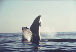
Ocean sanctuaries are unlikely to fully protect whales, say three independent scientists charged by the International Whaling Commission (IWC) with reviewing their sanctuary program to manage whale populations.
In a Policy Forum article forthcoming in the January 28 issue of the journal Science, Arizona State University marine biologist Leah Gerber, Duke University marine biologist K. David Hyrenbach, and University of Victoria geographer Mark Zacharias argue that the current san
Noise is usually nothing more than a disturbance, but sometimes it can be useful. Researchers have discovered that noise could bring order to chaotic systems, protect and maintain entire marine ecosystems, and even make the chemical industry greener. This research is reported today in a special Einstein Year issue of the New Journal of Physics (www.njp.org) published jointly by the Institute of Physics and the German Physical Society (Deutsche Physikalische Gesellschaft).
Changso
Proceedings of The Royal Society B: Biological Sciences
Tolerance for inequity increases with social closeness in chimpanzees by Dr SF Brosnan, Dr HC Schiff and Dr FBM de Waal. The evolution of the sense of fairness may have involved the strength of social connections, according to researchers at the Yerkes National Primate Research Center in Atlanta. Sarah Brosnan and Frans de Waal observed variability in chimpanzees’ responses to inequity depending on the strength of their so